Construction & Property Services
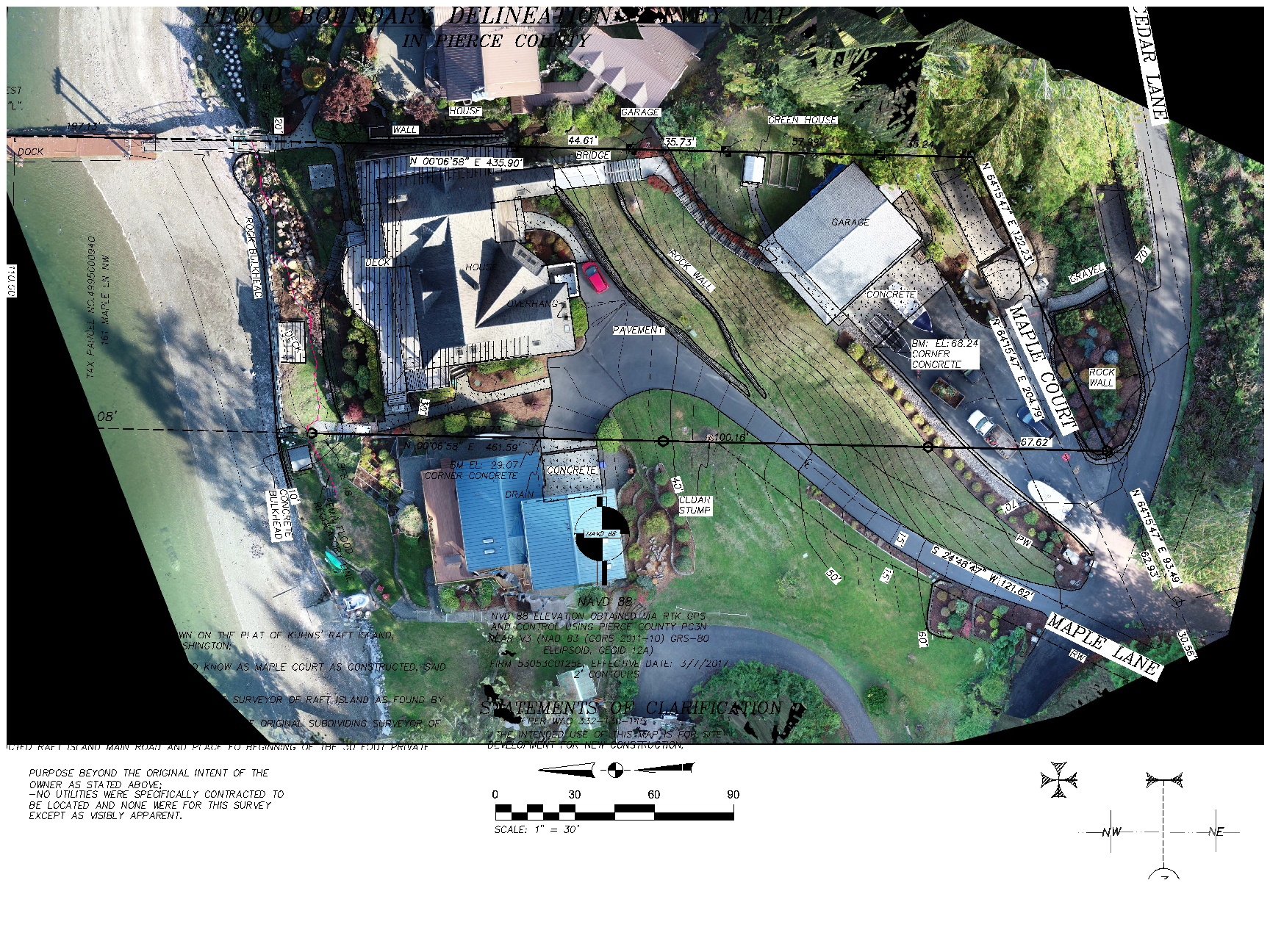
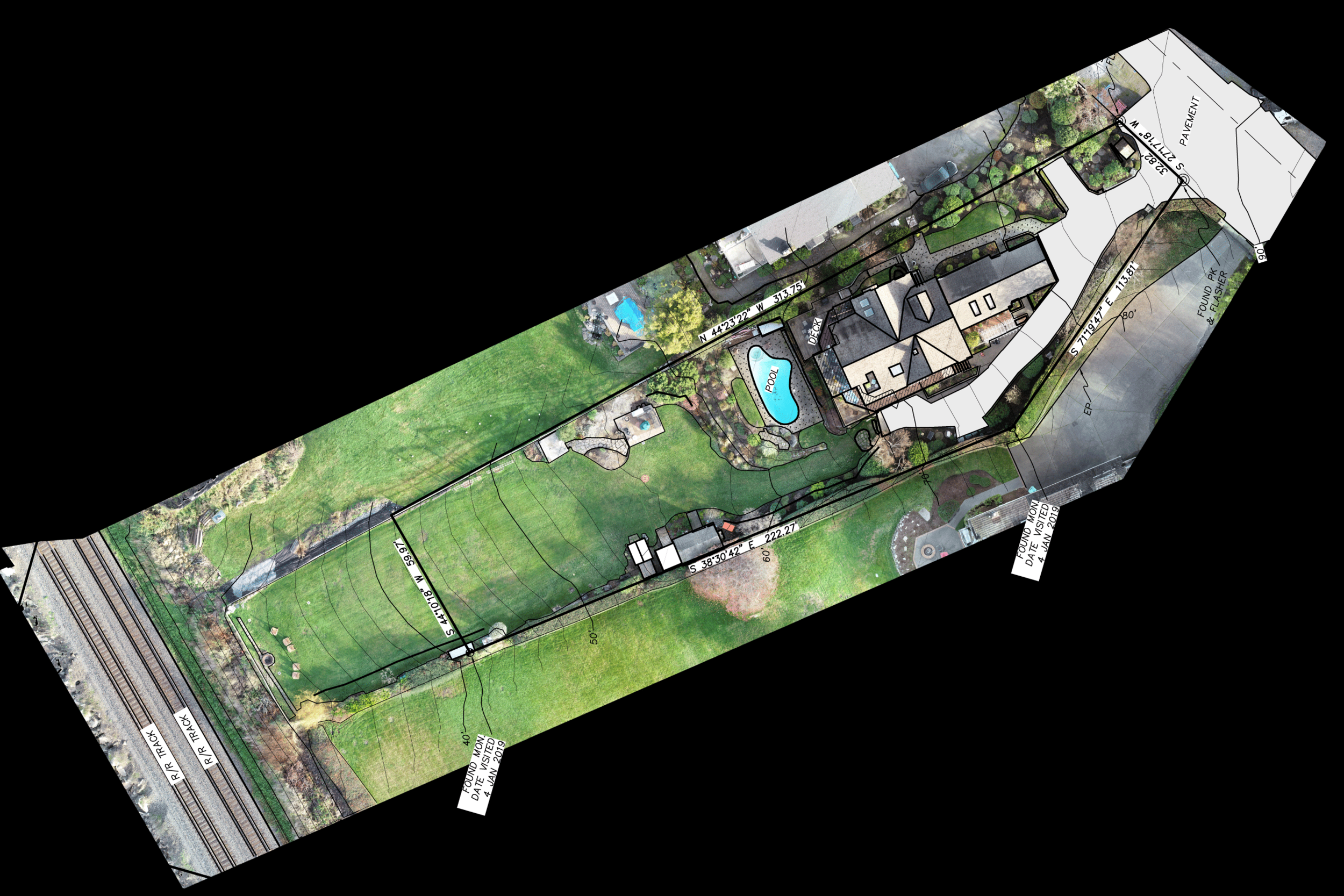
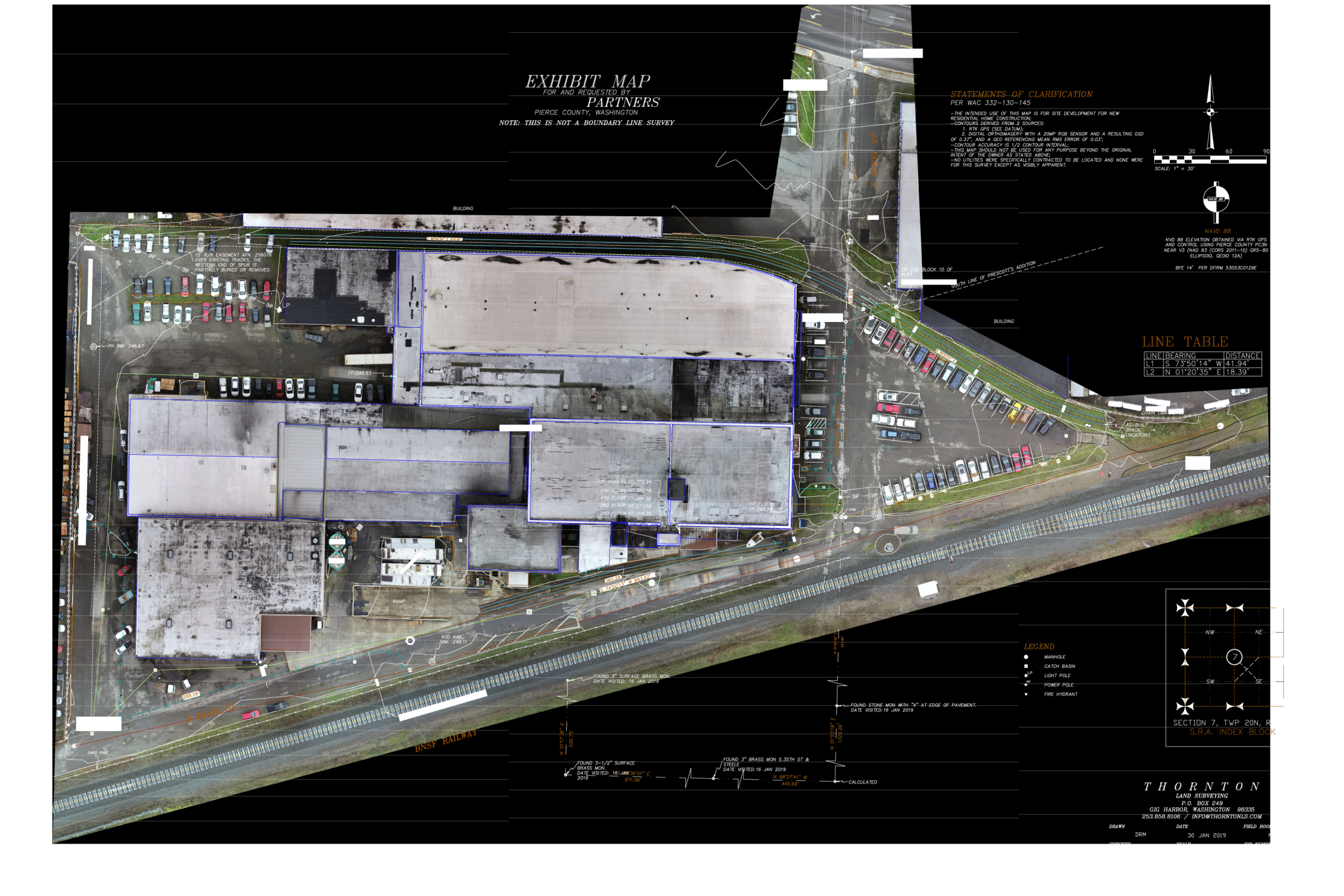
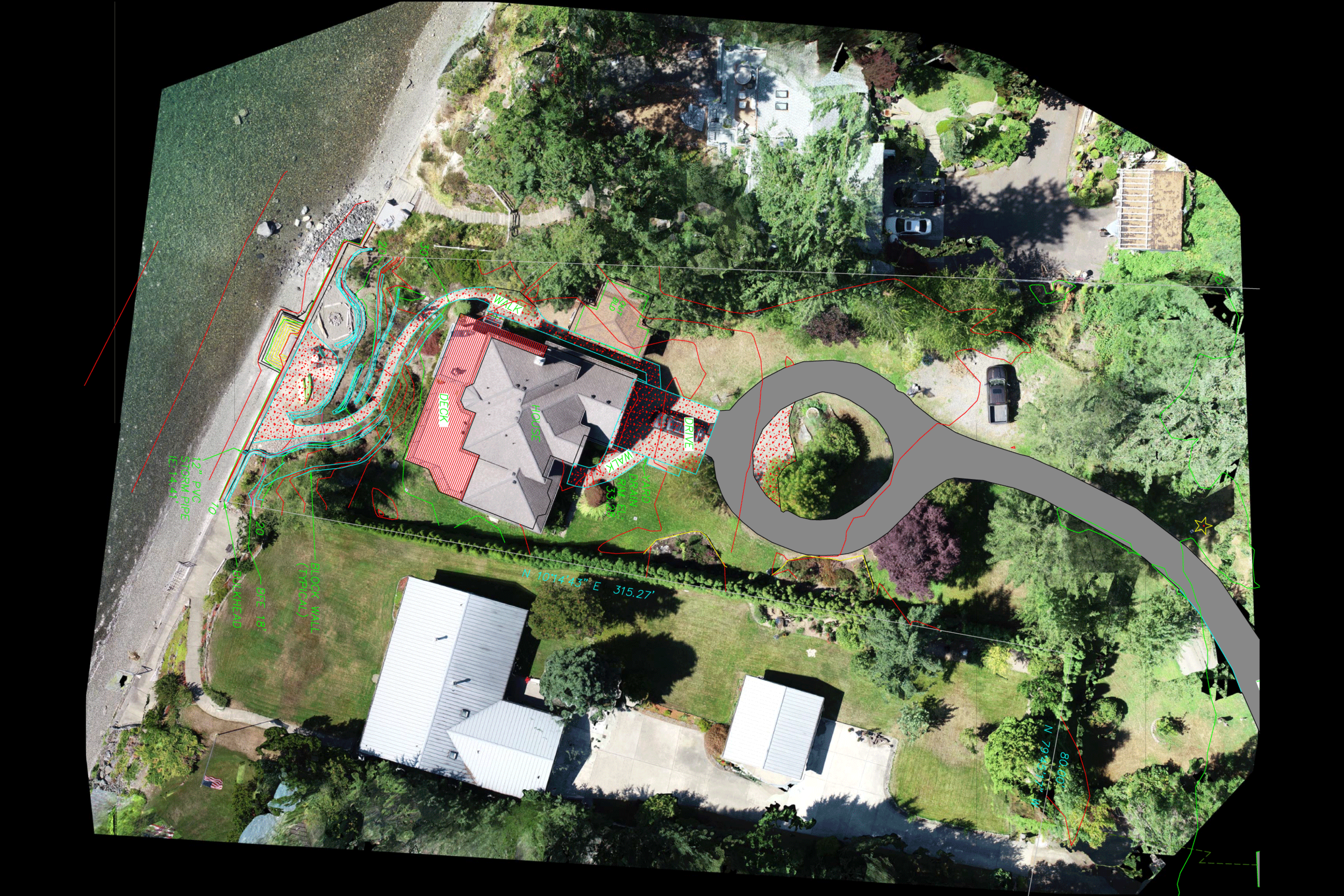
Surveying and Mapping

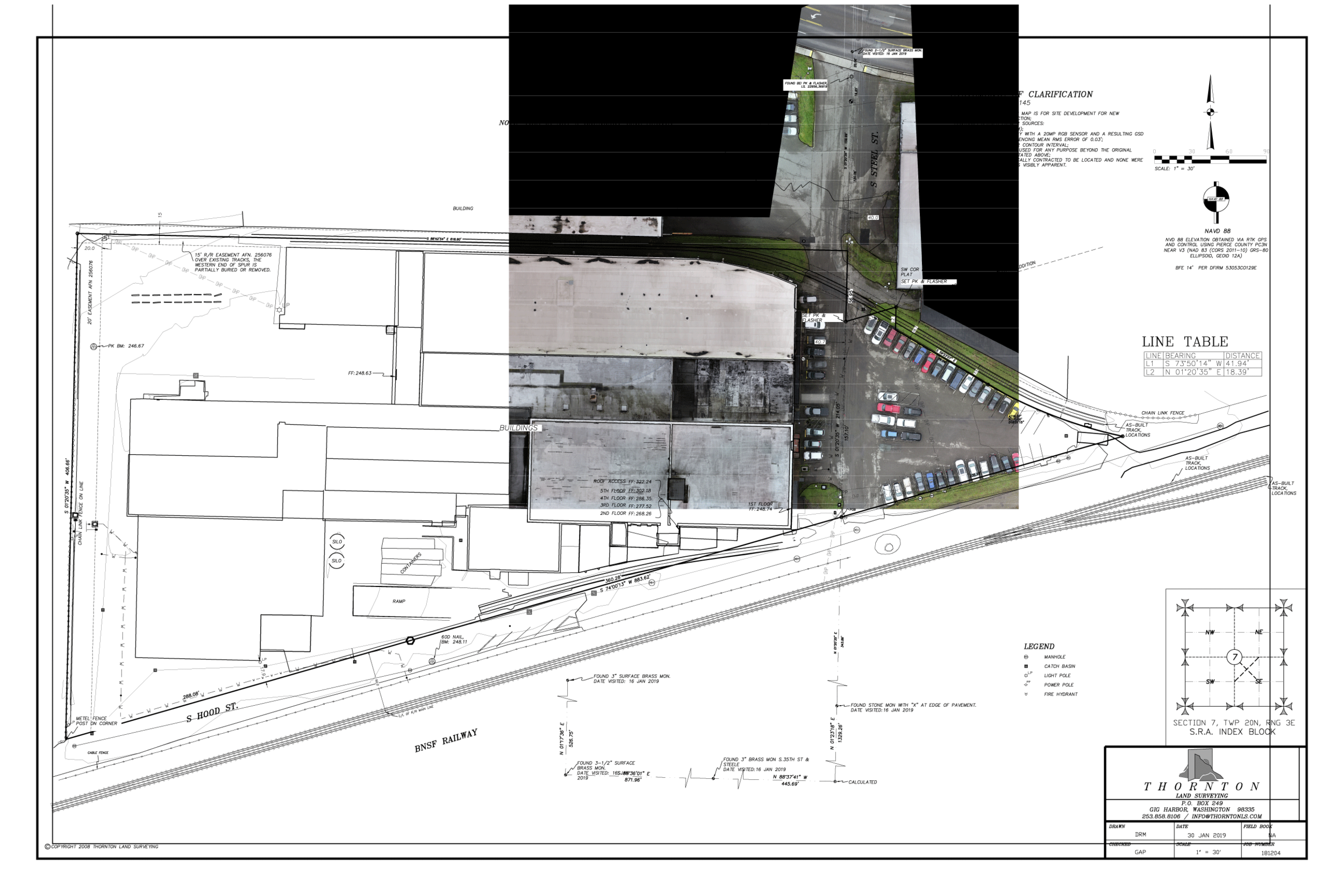
A professional land survey is essential to protecting your investment. Through documenting precise dimensions, inventory, and locations of your properties, you can ensure that your company does not encounter risk in the future. Residential or commercial, it is vital to understand the property boundaries and site logistics. And this is exactly what we will provide you with. We can assist you with the planning and layout of blocks, lots, easements and streets when reviewing a new development.
Drone Imagery Northwest will collect data and fully process your imagery or point clouds to produce CAD files, maps, or deliver georectified orthomosaics.


Stockpile Management
Aerial and ground based photogrammetry is pivotal in collecting precise volume calculations, visualizing contour lines, and conducting quality assessments using 2 and 3 dimensional models generated from multi-point data collection. It provides stakeholders with accurate data to apply to their own digital elevation and digital surface models in order to calculate stockpile volumes for waste mitigation and asset inventory. Extending the data dispersion into a comprehensive site analysis for allows continuous updating of stockpile inventory to validate quality and quantity of raw material.
Accordingly, mine operations are able to asses steeper slopes, prioritizing stacking and reclaiming, displacing less rock, and mitigating resource waste. Accurate stockpile volume calculations contribute to consistent inventory reporting into the project balance sheet, waste reduction for accounting, efficient supply chain organization, in addition to improved assessment of the materials inventory for sales teams.
Haul Road Optimization
Economic efficiency, environmental effects, and safety are all critical aspects of assessing haul road optimization. Build site roads are required to bear dense, dynamic loads due to the machinery on sites, quarries, and mining projects. So ensuring their design and maintenance are optimal is vital to job site integrity, risk mitigation, and workflow optimization. Incidents during construction can lead to costly setbacks, both in time and finances.
If you are looking for more information on haul road optimization, check out these handy tips on how to asses your current project.

Building Information Modeling
BIM is the processes of generating and managing of the physical and functional data of a build site. The output of the processes are what is referred to as building information models and are digital assets that detail the project for analysis and support decision making through the life cycle of the project. Typically BIM referred to as 3D modeling, however, there is more at stake than a digital representation of the site. BIM features more than just 3D geometric data, it can also serve project manager’s interest in evaluating time, cost, and final representation.
Drone imagery northwest will provide you the key insights into your project in order to keep your operation running smoothly and on budget. Be sure to contact us if you have any question about what services we can offer your organization, and we can provide accurate, effective data to your next project.

